Random or spatial subsampling? Compare the same scan.
We processed the built-in synthetic pavilion twice from the same original: once with a target of 5,000 points, and once with a minimum spacing of 0.25 coordinate units. Similar output counts conceal a useful difference in how the points are chosen.
1. Start with a known input
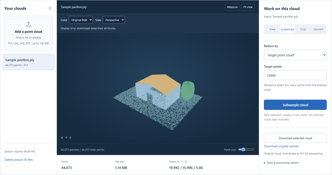
Open Point cloud subsampling and choose Try a sample cloud. Our input contains 44,073 points: a ground surface, pavilion roof and walls, and a tree-like shape. It is a synthetic demonstration, not a measured survey. The working binary PLY is 1,190,153 bytes; the original ASCII upload is 2,152,225 bytes. The table below compares working PLY files so that a text-to-binary encoding change is not mistaken for the effect of subsampling.
2. Use random sampling for a point budget
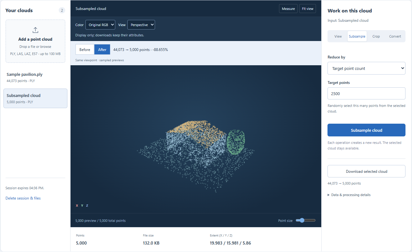
Keep Target point count selected, enter 5000 and click Subsample cloud. This run retained exactly 5,000 points, a reduction of about 88.65%, and produced a 135,181-byte PLY. Random selection spends the budget across all input points; it does not promise uniform spacing or preserve a particular corner, edge or sparse feature. Repeating the operation can select different points. The screenshot shows the completed result; the 2500 value in the form is the suggested next operation on that result, not the parameter used to create it.
3. Return to the original before trying spacing
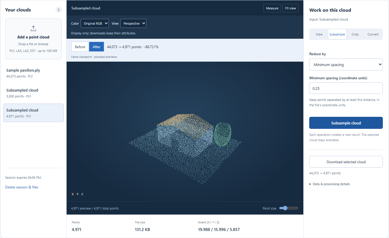
Select Sample pavilion.ply in Your clouds, rather than applying another reduction to the 5,000-point result. Choose Minimum spacing, enter 0.25 and run the operation. In this run the result contained 4,971 points and occupied 134,398 bytes. Spacing controls separation, not the output count: another scan with different density or extent can produce a very different count with the same value. Here 0.25 is a coordinate-unit distance. It means 25 centimeters only if the source coordinates are meters.
4. Compare coverage, not just the totals
Use Before and After to switch between each result and its input without changing the viewpoint. Inspect the roof outline, doorway and sparse parts of the tree-like shape. The random result has visibly uneven gaps; the spatial result spreads retained points more evenly across these sampled surfaces. This is an illustration on one synthetic input, not a ranking of geometric accuracy. Neither operation creates missing surfaces. Our original and both results fit below the 80,000-point preview limit; on larger uploads, the preview is itself sampled and cannot establish that every small feature survived.
5. Choose a setting for your next task
Use a target count when the receiving application has a point budget. Use spacing when the required separation has meaning in the source units. If only a small region is useful, crop it first and then allocate the budget to that region. Keep each result separate, inspect the downloaded PLY in the receiving application, and retain the original. A visually acceptable preview is not a survey-accuracy test, and file-size savings on this PLY example do not predict savings relative to a compressed LAZ upload.
| Operation on the original | Points | Binary PLY bytes |
|---|---|---|
| Import only | 44,073 | 1,190,153 |
| Random; target 5,000 | 5,000 | 135,181 |
| Spatial; spacing 0.25 | 4,971 | 134,398 |
Common questions
Will I get exactly 4,971 points?
Treat that as an observed result, not an output-count contract. The target-count mode controls count; the spatial mode controls spacing. Point ordering, engine changes and different inputs can change a spatial result.
Can the reduced cloud recover the original detail?
No. Select the original uploaded working cloud to try a different setting. Points discarded by an earlier reduction cannot be restored by processing its result.